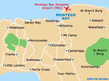
Montego Bay Sangster International Airport (MBJ)
Orientation and Maps
(Montego Bay, Jamaica)
Home to duty-free shops, a major cruise-ship port and some of the world's most stunning stretches of beach, Montego Bay is Jamaica's number four city in terms of overall population. Montego Bay is home to around 100,000 residents and features an appealing peninsula setting, lying on the north-western side of the island, next to Reading, Anchovy, Lucea and Falmouth.
On the northern side of Montego Bay, the Sir Donald Sangster International Airport (MBJ) is one of the largest and most important airports serving the Caribbean. Jamaica's premier airport, Sangster International Airport first opened in 1947 and can now handle around six million passengers per annum.
Montego Bay Sangster International Airport (MBJ) Maps: Important City Districts
Amongst the areas most noteworthy coastal resorts, Cave Beach is especially popular and features fine white sand and crystal clear waters, suitable for swimming. The beach stretches for around 200 metres / 656 feet and is edged by palm trees and places to both eat and drink. Also worth a trip, Cornwall Beach lies directly north and is home to the Montego Bay Beach Club, the Sundance Resort and the Sea Garden.
Many further resorts and be found along the coastline, with restaurants, shops and golf courses never far away. Montego Bay is also known for being home to the Cornwall Regional Hospital.
Jamaica Map

Montego Bay Map